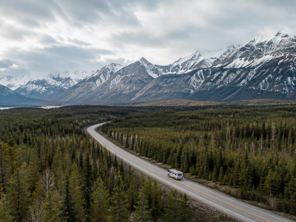
RV Route Guide
Alaska Highway RV Route: Kamloops to Northern BC
Route overview
This long-distance RV route runs north through British Columbia from Kamloops toward Dawson Creek, the start of the Alaska Highway, and on to the Yukon.
The guide is split into nine manageable driving sections. Each one covers places to camp, fuel and resupply, things to do, road notes and practical tips for RV travellers.
All nine sections are ready — from Kamloops through Clearwater, Valemount, McBride, Prince George, Chetwynd, Dawson Creek, Fort St. John, Fort Nelson, Muncho Lake and Liard River to the Yukon border and Watson Lake.
Route sections
- 1. Kamloops → Clearwater / Wells GrayLive
- 2. Clearwater → ValemountLive
- 3. Valemount → McBrideLive
- 4. McBride → Prince GeorgeLive
- 5. Prince George → Chetwynd / Dawson CreekLive
- 6. Dawson Creek → Fort St. JohnLive
- 7. Fort St. John → Fort NelsonLive
- 8. Fort Nelson → Muncho Lake / Liard RiverLive
- 9. Liard River → YukonLive
Section 1
Kamloops → Clearwater / Wells Gray
Route basics
- Start: Kamloops, at the meeting of the North and South Thompson rivers.
- Destination: Clearwater, the gateway town for Wells Gray Provincial Park.
- Highway 5 (the Yellowhead South) follows the North Thompson River the whole way — roughly 125 km, about 1.5 hours of driving without stops (approximate).
- Many RV travellers spend more than one night in both Kamloops and the Clearwater / Wells Gray area — there's a lot to see at each end.
Kamloops
The big resupply stop before heading north.
Why stay
- The largest city on this section, with full groceries, shopping and fuel.
- A good place to handle RV repairs, maintenance and supplies before services thin out.
- Warm, dry summers and plenty to do for a day or two.
Things to do
Riverside Park
Downtown beach, riverfront paths and summer evening concerts along the Thompson River.
Trails and outdoors
Hiking and mountain biking in the surrounding grasslands and hills, including Kenna Cartwright Park.
Fishing
Kamloops is known for lake fishing — dozens of lakes lie within a short drive of town.
Golf
Several courses in and around the city, with a long season thanks to the dry climate.
Secwépemc culture
Kamloops sits on the traditional territory of the Tk'emlúps te Secwépemc. Look for cultural experiences and heritage sites when you visit.
Kamloopa Powwow
One of the largest powwows in Western Canada, held in summer. Confirm current dates before planning around it.
Worth the detour: Sun Peaks
Sun Peaks is a mountain resort village about an hour's drive northeast of Kamloops — an easy optional side trip.
Summer brings lift-access mountain biking, hiking and alpine scenery; winter is all about skiing. The village has dining and services year-round.
BC by RV doesn't currently list an RV campground at Sun Peaks, so plan it as a day trip from Kamloops.
The road north from Kamloops
Highway 5 runs up the North Thompson valley through ranch land and small communities.
McLure
A rural stretch along the river with campground options just off the highway.
Barriere
The main town between Kamloops and Clearwater, with fuel, groceries and a few places to camp.
Little Fort
A small highway stop at the junction of Highway 24 toward the lakes of the Interlakes area.
Clearwater / Wells Gray
Waterfalls, wilderness and the service base for Wells Gray.
Why stay
- Clearwater is the main service town for exploring Wells Gray Provincial Park, with fuel, groceries and campgrounds.
- Wells Gray is one of BC's great wilderness parks, famous for its waterfalls and volcanic landscapes.
- The Clearwater Valley Road leads north from town into the park, passing many of the highlights.
Things to do
Helmcken Falls
The park's signature waterfall, plunging into a huge bowl-shaped canyon. Viewpoint close to the parking area.
Spahats Falls
A short walk to a viewpoint over a narrow canyon of layered lava rock — one of the first stops into the park.
Dawson Falls
A wide, curtain-like waterfall on the Murtle River, reached by a short trail.
Moul Falls
A walk-behind waterfall at the end of a forest trail near Clearwater — allow a couple of hours return.
Hiking
Trails range from short waterfall walks to longer day hikes and backcountry routes.
Rafting and paddling
Whitewater rafting on the Clearwater River, and canoeing on Clearwater and Azure lakes.
Fishing
Rivers and lakes throughout the area. Check current regulations and licence requirements.
Wildlife and scenic drives
Watch for moose, bears and deer along the Clearwater Valley Road, especially early and late in the day.
Campgrounds along this section
A few places to start. Open any listing for hookups, rates, seasons and contact details.
McLure, Barriere & Little Fort
- Pinegrove Campground & RV ParkMcLure
- Chinook Cove Golf & RVBarriere
- North Barriere Lake ResortBarriere
- Fox & Maple RV ResortLittle Fort
Fuel & resupply
Kamloops
Full groceries, big-box stores, Costco and widespread fuel including diesel. The best place on this section to stock up.
Barriere
Fuel and groceries in town — handy for a top-up midway.
Clearwater
Fuel and groceries — the last full-service stop before heading into Wells Gray.
Large rigs
We haven't confirmed specific big-rig fuel stops on this section yet. Choose larger stations and confirm access before pulling in.
RV services
Handle repairs and maintenance in the larger service centres along the route whenever possible. Kamloops is the main centre for RV parts and repairs on this section.
Section 2
Clearwater → Valemount
Route basics
- Start: Clearwater, gateway to Wells Gray Provincial Park.
- Destination: Valemount, a mountain village near the junction of Highways 5 and 16.
- Highway 5 continues north up the North Thompson Valley, past Avola and Blue River, then over to the Valemount area — roughly 200 km.
- Allow roughly 2½ hours of driving without long stops, but this is a route worth taking slowly.
- Services become more spread out north of Clearwater, so plan fuel and supplies ahead.
Before you leave Clearwater
- Fuel up.
- Pick up groceries and basic supplies.
- Check weather and highway conditions.
- Make sure campground plans are confirmed.
- Download offline maps if needed.
- Carry water and basic emergency supplies.
Highway 5 north — the North Thompson Valley
North of Clearwater the valley narrows and the mountains close in. Communities are small and spaced well apart, so this stretch rewards a little planning.
North Thompson Valley
The highway follows the river through forest and mountain scenery, with pull-offs and small recreation sites along the way.
Avola
A small community beside the highway — a quiet stop, but don't count on full services here.
Blue River
The natural midway stop between Clearwater and Valemount, with lakes and mountain views close to the highway.
Toward Valemount and Tête Jaune Cache
Past Blue River the road climbs out of the North Thompson toward the Valemount valley. Tête Jaune Cache, just beyond, is where Highway 5 meets Highway 16.
Road and RV notes
- Fuel opportunities are farther apart than between Kamloops and Clearwater.
- Large RV travellers should plan fuel stops rather than waiting until the tank is low.
- Wildlife can be on or near the highway — take extra care at dawn and dusk.
- Mountain weather can change quickly, even in summer.
- Construction or seasonal road work may affect travel times — check DriveBC before you go.
Blue River
A midway break with lakes, mountains and the way to Murtle Lake.
Why stay
- Blue River sits roughly halfway between Clearwater and Valemount — a natural place to stretch, rest and check fuel where available.
- Mountain scenery, nearby lakes and outdoor recreation make it worth more than a quick stop.
- It's also the access point toward Murtle Lake, in the remote northeast part of Wells Gray Park.
Things to do
Lakes and paddling
Small lakes near the community are good for a paddle or a quiet evening by the water.
Mountain scenery
The Monashee and Cariboo ranges rise on both sides of the valley.
Outdoor recreation
Hiking, fishing and backcountry recreation in the surrounding area. Check current regulations and conditions.
Worth the detour: Murtle Lake
Murtle Lake is part of Wells Gray Provincial Park, reached from the Blue River area. It's a remote wilderness lake with a paddling and canoeing focus.
Camping there is backcountry-style, at marine-accessible sites around the lake — not ordinary drive-in RV camping. Plan to leave the RV and go in by canoe or kayak.
This is not a quick roadside attraction. Check current access, road conditions and any registration or permit requirements with BC Parks before going.
Valemount
A mountain base surrounded by the Rockies, Monashees and Cariboos.
Why stay
- Valemount sits where three mountain ranges meet — the Rocky, Monashee and Cariboo Mountains — and near the junction of Highways 5 and 16.
- It's a practical RV base for the Mount Robson area, local hiking and biking, rivers and lakes, wildlife and the surrounding mountain valleys.
- Many travellers spend a couple of nights here rather than passing straight through.
Things to do
Valemount Visitor Centre
Open year-round, with maps, local and provincial travel information, activity ideas, seasonal advice and free Wi-Fi. A good first stop.
Cranberry Marsh
An easy loop walk with wildlife-viewing platforms — good for birding and a gentle leg-stretch after the drive.
Chinook salmon
Seasonal highlight — Chinook salmon can be seen spawning in the area in late summer, including near George Hicks Regional Park, typically in August. Confirm current timing locally before planning around it.
Hiking and biking
Local trails range from short walks to mountain-bike networks and longer hikes. Ask at the Visitor Centre for current conditions.
Rivers, lakes and wildlife
Rivers, lakes and mountain valleys close to town, with good chances of seeing wildlife.
Rearguard Falls
East of Valemount toward Highway 16, a short walk leads to falls where Chinook salmon can sometimes be seen leaping in season. Timing varies year to year.
Worth the detour: Mount Robson
Mount Robson, at 3,954 m the highest peak in the Canadian Rockies, is a side trip from Valemount — not on Highway 5. Head toward Highway 16 and east; it's roughly 20 minutes from the village.
Mount Robson Provincial Park offers scenic viewpoints, hiking from short walks to multi-day trails, and campgrounds within the park.
It's a strong reason to allow extra time in the Valemount area.
Campgrounds along this section
A few places to start. Open any listing for hookups, rates, seasons and contact details.
Blue River & the Highway 5 corridor
- Blue River Campground & RV ParkBlue River
- Avola Campground & RV ParkAvola
- Summit River Lodge & CampsitesAlbreda
Fuel & resupply
Clearwater
Your best chance to fill up and stock up before the longer, quieter stretch north.
Blue River
A small community — services are limited and hours can vary. Treat it as a possible top-up, not a planned fill-up.
Valemount
Fuel, groceries, restaurants and cafés, visitor information and basic travel supplies.
Large rigs
We haven't confirmed specific big-rig fuel stops on this section. Large RV access should be confirmed before pulling in.
RV services
Plan major repairs and big resupply runs in larger centres such as Kamloops, and confirm current local options in Valemount before relying on them.
Section 3
Valemount → McBride
Route basics
- Start: Valemount. Destination: McBride, in the heart of the Robson Valley.
- Head north a short way to Tête Jaune Cache, then turn west onto Highway 16 (the Yellowhead) and follow the upper Fraser River to McBride.
- Roughly 85 km, about an hour of driving without stops (approximate).
- It's a relatively short drive, but there are enough scenic stops and campground options to make it worth taking your time.
Before you leave Valemount
- Fuel up.
- Pick up groceries.
- Check Highway 16 conditions.
- Confirm campground plans.
- Check the weather.
- Plan any Mount Robson or Rearguard Falls stop before heading west.
Highway 16 west — the Robson Valley
West of Tête Jaune Cache, Highway 16 runs through the broad Robson Valley, with the Rockies on one side, the Cariboo Mountains on the other, and farms and forest along the Fraser River.
Tête Jaune Cache
The junction where northbound Highway 5 meets Highway 16 — turn west for McBride and Prince George, or east for Mount Robson and Jasper.
Dunster
A small rural community just off the highway, in a quiet farm-and-river setting between Tête Jaune and McBride.
McBride
The main town in the Robson Valley, with fuel, groceries and places to stay.
Road and RV notes
- Highway 16 through the Robson Valley is scenic and relatively rural.
- Services are more spread out than in larger centres — travellers in larger rigs should plan fuel and stops ahead.
- Wildlife may be on or near the highway, especially at dawn and dusk.
- Mountain weather can change quickly.
- Road work or seasonal conditions can affect travel time — check DriveBC before you go.
Tête Jaune Cache & the Highway 16 junction
Where Highway 5 ends and the Robson Valley begins.
Why stay
- This is the transition from the northbound Highway 5 corridor onto Highway 16 west through the Robson Valley.
- If you skipped Mount Robson while staying in Valemount, this is your last easy opportunity to include it before continuing west toward McBride — it's a short side trip east on Highway 16.
- There's a riverside campground right at Tête Jaune if you'd rather stop here than in Valemount or McBride.
Things to do
Mount Robson side trip
Head east on Highway 16 for viewpoints and trails in Mount Robson Provincial Park, then double back west. See the Valemount section above for details.
Fraser River
The highway follows the young Fraser River west from here toward McBride.
Dunster
A quiet rural stop in the Robson Valley.
Why stay
- Dunster is a small farming community set between the river and the mountains — a glimpse of rural Robson Valley life.
- Services are very limited, so treat it as a scenic pause rather than a resupply stop.
Things to do
Valley scenery
Farmland, river flats and mountain views — a pleasant short detour off the highway.
Worth a Stop: Dunster Station Museum
Dunster's historic railway station is now a small museum — a worthwhile heritage stop if you're interested in the Robson Valley's railway and settlement history. It's roughly 30 km east of McBride. Small heritage sites often keep seasonal or limited hours, so confirm current opening times before making a special trip.
McBride
A railway town and practical overnight stop in the Robson Valley.
Why stay
- McBride is a practical overnight stop and the main place to resupply before the longer drive west to Prince George.
- It grew up as a divisional point on the Grand Trunk Pacific Railway, and the historic station is still the focus of Main Street.
- It's a relaxed base for local hiking, scenery and outdoor recreation — a good stop for travellers who want more than just fuel.
Things to do
Historic railway station
The picturesque station, completed in 1919, sits at the head of Main Street and is still a stop on the passenger rail line. It houses the Whistle Stop Gallery, featuring local artists — check current hours before visiting.
Main Street
A short, walkable downtown with cafés and shops — easy to explore on foot from the station.
Hiking and viewpoints
Trails in the surrounding mountains offer views over the Robson Valley. Ask locally about current trail and road conditions.
Rivers and outdoor recreation
The Fraser River and nearby lakes and creeks offer fishing and quiet time outdoors. Check current regulations.
Campgrounds along this section
A few places to start. Open any listing for hookups, rates, seasons and contact details.
Fuel & resupply
Valemount
The best place to start this section fully fuelled and stocked.
Dunster
Very limited services — don't plan on fuel or groceries here.
McBride
Fuel, groceries, restaurants and cafés, and general travel supplies. The last town of any size before Prince George.
Large rigs
We haven't confirmed specific big-rig fuel stops on this section. Large RV access should be confirmed before pulling in.
RV services
If you need major repairs, confirm current local options before relying on them, or continue to a larger centre such as Prince George.
Section 4
McBride → Prince George
Route basics
- Start: McBride, in the Robson Valley. Destination: Prince George, the largest city in northern BC.
- Highway 16 continues west along the upper Fraser River through forest and small settlements — roughly 210 km.
- Allow roughly 2½ hours of driving without long stops, with more time if you explore the smaller communities and recreation sites along the way.
- Prince George is the major resupply and service centre before heading north toward Chetwynd, Dawson Creek and the Alaska Highway.
Before you leave McBride
- Fuel up.
- Pick up groceries.
- Check Highway 16 conditions.
- Confirm campground plans.
- Check the weather.
- Plan fuel and supplies to get you to Prince George.
Highway 16 west — the upper Fraser corridor
West of McBride the valley closes in and the highway runs through long stretches of forest with few services. Small settlements such as Dome Creek, Penny, Sinclair Mills and Upper Fraser lie near the route, but they are route markers rather than service stops.
Upper Fraser corridor
Forest, river and mountain scenery with very limited services — plan to be self-sufficient between McBride and Prince George.
Purden Lake
About an hour east of Prince George, a lake with a provincial park campground and a private RV resort — a good break, or a quieter alternative to staying in the city.
Approaching Prince George
The highway leaves the forest corridor and enters the city from the east, close to the Fraser River and downtown.
Road and RV notes
- This is a rural stretch with services spread out.
- Larger rigs should plan fuel and stops in advance.
- Wildlife may be on or near the highway, especially at dawn and dusk.
- Weather can change quickly.
- Road work or seasonal conditions may affect travel.
- Check DriveBC for current conditions before you go.
Prince George
Northern BC's largest centre — resupply, repairs and a night or two in town.
Why stay
- Prince George is the largest service centre on this part of the route, where Highways 16 and 97 meet.
- It's the place for a major fuel, grocery and supply stop, and one of the best places on this route to handle RV repairs, parts and general service before heading farther north.
- Many travellers spend one or two nights here before continuing north toward Chetwynd, Dawson Creek and the Alaska Highway.
Things to do
Lheidli T'enneh Memorial Park
A large riverside park near downtown, on land with deep significance to the Lheidli T'enneh. Home to The Exploration Place.
The Exploration Place
Museum and science centre covering regional history, natural history and hands-on exhibits — a good rainy-day option. Check current hours.
Cottonwood Island Nature Park
Easy, flat trails through cottonwood forest where the Nechako meets the Fraser River.
Forests for the World
A trail network on the edge of town with lakes, forest walks and viewpoints over the city.
Railway & Forestry Museum
Outdoor and indoor collections of locomotives, rail cars and forestry equipment, reflecting the industries that built the city. Check seasonal hours.
Trails and outdoors
Riverfront walks, lakes and fishing within easy reach of the city. Check current regulations.
Campgrounds along this section
A few places to start. Open any listing for hookups, rates, seasons and contact details.
Purden Lake (Highway 16 east of Prince George)
See all campgrounds near PurdenFuel & resupply
McBride
Start this section fully fuelled — services between McBride and Prince George are very limited.
Between McBride and Prince George
Don't count on fuel along the corridor. Plan to reach Prince George on what you carry.
Prince George
Multiple fuel options including diesel, full groceries, major retail, supplies, and RV repair and service options.
Large rigs
We haven't confirmed specific big-rig fuel stops. Choose larger stations and confirm access before pulling in.
RV services
Prince George is one of the best places on this route to handle RV repairs, parts and general service before heading farther north.
Section 5
Prince George → Chetwynd / Dawson Creek
Route basics
- Start: Prince George. Destination: Dawson Creek, the traditional Mile 0 of the Alaska Highway.
- Highway 97 north (the John Hart Highway) climbs over Pine Pass to Chetwynd — roughly 300 km, around 3½–4 hours without long stops (approximate).
- Chetwynd to Dawson Creek is roughly 100 km more, about 1¼ hours (approximate).
- This is a longer northern driving day, and many RV travellers will prefer to break it at Chetwynd rather than push straight through to Dawson Creek.
Before you leave Prince George
- Fill fuel tanks.
- Stock up on groceries.
- Top up propane if needed.
- Handle any repairs or maintenance.
- Confirm campground plans.
- Check Highway 97 and Pine Pass conditions.
- Check the weather.
- Download offline maps if useful.
- Plan your next fuel stops carefully.
Highway 97 north — over Pine Pass
North of Prince George the highway runs through lake and forest country, then climbs through the Rockies at Pine Pass before dropping to Chetwynd. Services become more spread out once you leave the city.
Bear Lake & McLeod Lake
Small highway communities north of Prince George, with provincial park campgrounds nearby. Limited services — don't rely on them for a full resupply.
Mackenzie Junction
The turnoff for the town of Mackenzie, well off the highway. Most through travellers continue north.
Pine Pass
The highway's crossing of the Rocky Mountains, with mountain and lake scenery. Weather here can differ sharply from the valleys.
East Pine to Dawson Creek
East of Chetwynd the land opens into the farmland of the Peace River country, passing East Pine on the way to Dawson Creek.
Moberly Lake
North of Chetwynd on Highway 29 (not on the way to Dawson Creek), with a provincial park campground on the lake.
Pine Pass and road notes
- Mountain weather can change quickly on Pine Pass, and snow can occur outside the main winter months.
- Road conditions can change with weather and construction — check DriveBC before you leave.
- Distances are long and services are spread out. Fuel planning matters more on this stretch.
- Large RVs should leave Prince George with adequate fuel and supplies.
- Wildlife may be on or near the highway, especially at dawn and dusk.
- Road work and seasonal conditions can affect travel times.
Chetwynd
A useful overnight and resupply stop at the end of Pine Pass.
Why stay
- Chetwynd is a practical overnight between Prince George and Dawson Creek, and a useful fuel and resupply point.
- It's a small northern service centre with groceries and basic supplies.
- A good place to check road and weather conditions before continuing.
Things to do
Chainsaw carvings
Carvings are displayed throughout town — easy to see on a short walk or drive.
Chainsaw carving event
Seasonal highlight — Chetwynd hosts a chainsaw carving competition. Confirm current dates before planning around it.
Lakes nearby
Moberly Lake, north on Highway 29, has a provincial park campground and lake access.
Worth a Stop: Chainsaw Carvings
Chetwynd is well known for its large collection of chainsaw carvings displayed around town. Pick up a chainsaw carving tour map or visitor information before exploring the carvings.
Dawson Creek
Mile 0 of the Alaska Highway.
Why stay
- Dawson Creek is the traditional Mile 0 of the Alaska Highway — a milestone for anyone driving north.
- It's a major service and resupply point and a logical place to spend at least one night.
- Fuel, shop, handle repairs and prepare here for the long northern sections ahead.
Things to do
Mile 0 Post
The famous marker downtown — the classic photo stop for Alaska Highway travellers.
Visitor Centre
Maps, road information and local advice for the drive north. Check current hours.
Alaska Highway House
Exhibits on the highway's construction and history, near the Mile 0 Post. Check current hours.
Northern Alberta Railway Park
A heritage site around a restored grain elevator and railway station, home to the visitor centre and art gallery.
Mile 0 of the Alaska Highway
The Alaska Highway was built in 1942 as a wartime supply route, starting from the railhead at Dawson Creek and running north through BC and the Yukon to Alaska.
Dawson Creek has been the highway's starting point ever since. From here, the next sections of this guide head north to Fort St. John, Fort Nelson and the Yukon.
Campgrounds along this section
A few places to start. Open any listing for hookups, rates, seasons and contact details.
Highway 97 north of Prince George
- Summit Lake ResortSummit Lake
- Crooked River Provincial ParkBear Lake
- Whiskers Point Provincial ParkMcLeod Lake
Fuel & resupply
Prince George
Leave well stocked — fuel, groceries and propane are far easier to find here than on the road north.
Chetwynd
Fuel, groceries, food and basic travel supplies.
Dawson Creek
A major resupply point: fuel and diesel, groceries, hardware and general supplies, propane where available, and RV supplies and repair options.
Large rigs
We haven't confirmed specific big-rig fuel stops on this section. Large RV access should be confirmed before pulling in.
RV services
Chetwynd and Dawson Creek both have service options, but Dawson Creek is the stronger place to handle repairs, parts and resupply before continuing farther north.
Section 6
Dawson Creek → Fort St. John
Route basics
- Start: Dawson Creek, Mile 0. Destination: Fort St. John, the main service centre of northeast BC.
- Highway 97 — now the Alaska Highway — runs north through Peace River farmland, crossing the Peace River at Taylor. Roughly 75 km, about an hour of driving without stops (approximate).
- This is one of the shorter driving sections on the route, so many travellers use the day to explore Dawson Creek before leaving or spend extra time in Fort St. John.
Before you leave Dawson Creek
- Fuel up.
- Pick up groceries.
- Top up propane if needed.
- Check Highway 97 conditions.
- Confirm campground plans.
- Check the weather.
- Handle any repairs before continuing north.
- Plan your next fuel stop.
Leaving Mile 0 — north on the Alaska Highway
Pulling out of Dawson Creek is where the drive north on the Alaska Highway truly begins. The kilometre posts now count up from Mile 0, and the road heads across open Peace River country toward Fort St. John.
Kiskatinaw River
A short side trip onto a preserved stretch of the original highway alignment, with a provincial park campground by the river.
Taylor & the Peace River
The highway drops into the Peace River valley and crosses the river at Taylor, with river views on the descent.
Into Fort St. John
The highway climbs out of the valley to Fort St. John, the largest centre in northeast BC.
Road and RV notes
- This is a relatively short leg.
- Traffic can include commercial and industrial vehicles.
- Wildlife may be on or near the highway, especially at dawn and dusk.
- Northern weather can change quickly.
- Road work may affect travel.
- Check DriveBC before departure.
Kiskatinaw & the Old Alaska Highway
A glimpse of the highway as it was first built.
Why stay
- North of Dawson Creek, a section of the original Alaska Highway alignment loops off the main road toward the Kiskatinaw River.
- It's a quiet heritage stop for travellers interested in the highway's early history, with a provincial park campground nearby.
Things to do
Original highway alignment
Drive or walk a stretch of the early route and get a feel for how the highway first wound through the valley.
Kiskatinaw Provincial Park
A riverside campground on the old highway — see the campground list below.
Worth a Stop: Kiskatinaw Bridge
The Kiskatinaw River crossing on the old highway is known for its historic curved wooden bridge, one of the few original timber structures from the Alaska Highway's early years.
Check current road conditions and vehicle suitability before leaving the main highway, and confirm whether the bridge is currently open to vehicles — access and restrictions can change.
Fort St. John
Northeast BC's service centre and the last big stop before the remote north.
Why stay
- Fort St. John is a major northeast BC service centre — an important place for fuel, groceries, repairs and supplies.
- It's a logical overnight before the much longer run toward Fort Nelson.
- Deal with any mechanical or RV issues here before heading into more remote country.
Things to do
Fort St. John North Peace Museum
A local heritage museum covering the region's history, including the Alaska Highway era. Check current hours.
Centennial Park
The city's main park, close to the museum — a good place to stretch your legs.
Peace River views
Viewpoints over the Peace River valley south of town, on the way in from Taylor.
Charlie Lake
Just north of town, with two provincial park campgrounds, lake access and a quieter alternative to staying in the city.
Campgrounds along this section
A few places to start. Open any listing for hookups, rates, seasons and contact details.
Kiskatinaw & Taylor
See all campgrounds near TaylorFuel & resupply
Dawson Creek
A good place to leave fully stocked, even on this short leg.
Fort St. John
A major resupply stop: fuel and diesel, groceries, propane where available, hardware, RV supplies, and repair and service options.
Large rigs
We haven't confirmed specific big-rig fuel stops on this section. Large RV access should be confirmed before pulling in.
RV services
Fort St. John is one of the best places on this route to handle repairs, maintenance, parts and resupply before continuing north.
Section 7
Fort St. John → Fort Nelson
Route basics
- Start: Fort St. John. Destination: Fort Nelson, the major service centre of northern BC.
- Highway 97 — the Alaska Highway — runs north through long stretches of forest, river valleys and foothills. Roughly 380–390 km, around 4½–5 hours of driving without long stops (approximate).
- This is a much longer and more remote driving section. Allow most of the day once fuel, food, wildlife, weather, and rest stops are included.
- There's no need to rush it — an early start and regular breaks make for a far better day.
Before you leave Fort St. John
- Fill fuel tanks.
- Top up propane if needed.
- Stock groceries.
- Carry drinking water.
- Check tires and the spare.
- Check engine fluids.
- Handle any repairs before leaving.
- Confirm campground plans.
- Check Highway 97 conditions on DriveBC.
- Check the weather.
- Download offline maps if useful.
- Plan your fuel stops.
- Make sure phones and devices are charged.
- Carry basic emergency supplies.
Highway 97 north — into the remote country
North of Charlie Lake, towns give way to small highway communities spread far apart. Services are fewer, cell coverage can be patchy, and the road settles into a long, steady drive toward Fort Nelson.
North of Charlie Lake
The last of the Fort St. John area. Inga Lake Recreation Site sits just off the highway for anyone wanting a quiet early stop.
Wonowon
A small highway community and route marker. It may offer fuel or a rest break, but don't assume every service is open — confirm current fuel and service availability before relying on this stop.
Pink Mountain
Remote northern country with mountain views and good wildlife habitat. Pink Mountain Campsite & RV Park is listed here. Confirm current fuel and service availability before relying on this stop.
Sikanni Chief
The highway crosses the Sikanni Chief River, where Sikanni River Campground & RV Park is listed — a useful riverside overnight for breaking up the drive.
Buckinghorse River
A small BC Parks wayside campground beside the highway — handy for a rest break or a simple overnight.
Prophet River
A route marker along the river valley. Services here are very limited, so treat it as a place you pass rather than a planned stop.
Into Fort Nelson
The highway reaches Fort Nelson, the last major centre before the northern Rockies.
Fuel Planning
- Leave Fort St. John with a full tank.
- Fuel stops are farther apart on this section.
- Some stations may have limited or seasonal hours.
- Do not assume every fuel stop shown on a map is operating.
- Larger RVs and tow vehicles should plan conservatively.
- Fort Nelson is the next major service centre.
Wildlife and Weather
- Wildlife: moose, deer, bears and other northern wildlife may be on or beside the road. Take extra care at dawn and dusk.
- Construction and road maintenance may affect travel.
- Weather: cold mornings, heavy rain, wind, or sudden weather changes are possible even outside winter.
- Check DriveBC before departure.
Pink Mountain & Sikanni Chief
Remote highway country and natural places to break up the drive.
Why stay
- Roughly the middle of the drive, this stretch is where many travellers take a longer break or stop for the night.
- Both Pink Mountain and the Sikanni Chief River have campground listings, so you don't have to cover the whole distance in one day.
Things to do
Break the drive
Splitting this leg into two shorter days takes the pressure off and leaves more time to enjoy the scenery.
Riverside stop
The Sikanni Chief River crossing is a natural place to stretch your legs.
Fort Nelson
The northern service centre and the gateway to the northern Rockies.
Why stay
- Fort Nelson is the major service centre after Fort St. John — the place to fuel up and fully resupply.
- A good overnight or multi-night stop after a long day on the highway.
- Handle repairs here before continuing into the northern Rockies.
- It's the last major centre before the more remote Muncho Lake / Liard River section.
Things to do
Fort Nelson Heritage Museum
A local museum focused on Alaska Highway and northern history, including historic vehicles and equipment. Check current hours.
Visitor Centre
Stop in for road information, maps, travel planning and current local guidance before heading north. Check current hours.
Stretch your legs
Walking trails and green space around town are a welcome break after a long drive.
Campgrounds along this section
A few places to start. Open any listing for hookups, rates, seasons and contact details.
North of Fort St. John
See all campgrounds near Fort St. JohnPink Mountain / Sikanni corridor
See all campgrounds near SikanniFuel & resupply
Fort St. John
Leave fully stocked — fuel, groceries, water and propane.
Along the highway
Small highway communities may have limited services. Don't rely on them without confirming they're open.
Fort Nelson
The major resupply stop: fuel and diesel, groceries, propane where available, hardware, restaurants, RV supplies, and repair and service options.
RV services
Fort Nelson is the place to deal with repairs, parts, and maintenance before continuing into the more remote northern Rockies.
Section 8
Fort Nelson → Muncho Lake / Liard River
Route basics
- Start: Fort Nelson. Destination: Liard River Hot Springs, by way of Stone Mountain, Toad River and Muncho Lake.
- This is a long, remote and exceptionally scenic section of the Alaska Highway. Many RV travellers will want to break the drive around Toad River or Muncho Lake rather than rush through to Liard River.
- The highway climbs from the lowlands into the northern Rockies, and scenery, wildlife and frequent stops mean travel is often slower than the distance suggests.
Before you leave Fort Nelson
- Fill fuel tanks.
- Top up propane if needed.
- Stock groceries.
- Carry drinking water.
- Check tires and the spare.
- Check engine fluids.
- Handle any repairs before leaving.
- Confirm campground plans.
- Check Highway 97 conditions on DriveBC.
- Check the weather.
- Download offline maps.
- Plan fuel stops carefully.
- Charge phones and devices.
- Carry basic emergency supplies.
- Confirm the operating status of remote services ahead.
Into the northern Rockies
West of Fort Nelson the land rises steadily. Forest gives way to mountain valleys, rivers and rocky peaks, and this becomes one of the most scenic drives anywhere on the Alaska Highway.
Tetsa River
A simple regional campground along the highway on the climb toward Stone Mountain.
Stone Mountain & Summit Lake
The highway crosses a high mountain pass in Stone Mountain Provincial Park, where Summit Lake sits right beside the road — a striking place to stop and stretch.
Toad River
A small highway community and a natural break between Fort Nelson and Muncho Lake.
Muncho Lake
A long mountain lake right beside the highway — one of the signature stops on the route.
Liard River Hot Springs
The end of this section: a provincial park built around natural hot springs.
Fuel Planning
- Leave Fort Nelson with a full tank.
- Fuel and services are much more widely spaced on this section.
- Remote stations can have limited or seasonal hours.
- Do not rely blindly on old map listings.
- Confirm key fuel stops before departure.
- Larger RVs and tow vehicles should plan conservatively.
- Carry enough margin to handle a closed or unavailable stop.
Wildlife
- This stretch is known for wildlife, including Stone sheep in the mountains, moose and bears, and bison along the highway farther north.
- Caribou may also be seen in the northern Rockies.
- Wildlife may be on or beside the highway. Slow down, give animals space, and never stop in a way that blocks traffic.
- Sightings are never guaranteed.
Road and RV notes
- This is a remote highway with long distances between services.
- Even in summer, mountain weather can change quickly. Cold mornings, rain, wind, and sudden temperature changes are possible.
- Wildlife is common on and beside the road.
- Road work may affect travel.
- Seasonal closures or service changes are possible.
- Cell coverage is limited in places — offline maps are important.
- Don't arrive at a remote fuel stop nearly empty.
- Check DriveBC before departure.
Stone Mountain & Summit Lake
Where the northern Rockies begin.
Why stay
- The landscape becomes much more mountainous, with dramatic valley and mountain scenery.
- Summit Lake, in Stone Mountain Provincial Park, sits right beside the highway at the top of the pass.
- A BC Parks campground at Summit Lake is listed below.
Things to do
Summit Lake
A mountain lake beside the highway — a good short stop for views and photos.
Wildlife watching
Stone sheep are often seen along this stretch. Pull over only where it's safe.
Scenic driving
Allow extra time — this is a section where many people stop often.
Toad River
A natural break between Fort Nelson and Muncho Lake.
Why stay
- Toad River is a small highway stop that splits the drive between Fort Nelson and Muncho Lake.
- It may offer fuel, food and a rest break, and Toad River Lodge RV Park is listed here.
- Surrounded by northern Rockies scenery.
Things to do
Rest and refuel
Confirm current fuel, food and campground availability before relying on Toad River as your only stop.
Muncho Lake
One of the signature scenic stops on the Alaska Highway.
Why stay
- Muncho Lake is a long mountain lake that runs right beside the highway inside Muncho Lake Provincial Park.
- A strong place to slow down rather than simply drive through.
- Several campgrounds make it a good overnight or multi-night stop.
Things to do
Lake viewpoints
The highway follows the shoreline, with places to pull over and take in the views.
Paddling
Calm days are good for canoeing or kayaking. Mountain lakes are cold and wind can rise quickly.
Photography
Mountain reflections and changing light make this one of the most photographed spots on the route.
Wildlife viewing
Watch for Stone sheep and other wildlife along the road.
Short walks
Stretch your legs along the shoreline and around the campgrounds.
Muncho Lake Provincial Park
The park protects the lake and the surrounding mountains, with BC Parks campgrounds along the shore.
See the campground list below and check current BC Parks information before arrival.
Liard River Hot Springs
One of the most famous stops on the northern Alaska Highway.
Why stay
- A provincial park built around natural hot springs — one of the best-known stops on the whole highway.
- A strong overnight or longer break before continuing toward the Yukon.
Things to do
The hot springs
A boardwalk leads through the forest to natural hot pools.
Day use or overnight
Stop for a soak on the way through, or stay at one of the nearby campgrounds.
Wildlife
Wildlife may be in the area. Keep your distance and follow park guidance.
Campgrounds along this section
A few places to start. Open any listing for hookups, rates, seasons and contact details.
Fuel & resupply
Fort Nelson
The last major centre on this section — leave fully stocked with fuel, groceries, water and propane.
Along the highway
Lodges and small highway stops may have limited services and hours. Confirm before relying on them.
RV services
Once north of Fort Nelson, repair options become much more limited. Handle mechanical or RV issues before leaving town whenever possible.
Section 9
Liard River → Yukon
Route basics
- Start: Liard River Hot Springs. Destination: the Yukon border and Watson Lake, the first major Yukon service centre.
- The final BC stretch of the Alaska Highway is remote, scenic, and lightly serviced. Give yourself plenty of time, keep fuel planning conservative, and treat Watson Lake as the next major service point.
Before you leave Liard River
- Fill fuel tanks where available.
- Carry drinking water.
- Stock snacks and groceries.
- Check tires and the spare.
- Check fluids.
- Confirm campground plans.
- Check road conditions.
- Check the weather.
- Download offline maps.
- Confirm remote services ahead.
- Charge phones and devices.
- Carry basic emergency supplies.
The final BC stretch
North of Liard River the highway follows the Liard River valley through quiet, lightly serviced country toward the Yukon. These are orientation points rather than stops.
Contact Creek
A route marker near where the highway first dips toward the BC–Yukon boundary.
Lower Post area
A small community on the BC side, close to the Yukon border. Services are limited.
BC / Yukon border
The end of the British Columbia portion of the route — the Alaska Highway continues into Yukon toward Watson Lake.
Fuel Planning
- Do not leave the Liard River area nearly empty.
- Fuel opportunities can be limited and far apart.
- Remote stations may have limited or seasonal hours.
- Do not rely blindly on old map listings.
- Confirm key stops before departure.
- Larger RVs and tow vehicles should plan conservatively.
- Watson Lake is the next major service point.
Wildlife
- Bison are often seen along the highway in this area, along with bears, moose and other northern wildlife. Caribou may also be seen.
- Wildlife may be on or beside the highway. Slow down, give animals space, and never stop in a way that blocks traffic.
- Sightings are never guaranteed.
Entering Yukon
- This section marks the end of the British Columbia portion of the route.
- The Alaska Highway continues into Yukon, and Watson Lake is the first major Yukon service centre on this route.
- After crossing, check current Yukon road and visitor information.
Road and RV notes
- This is a remote highway with long distances between services.
- Cell coverage is limited — download offline maps before leaving.
- Wildlife is common on and beside the road.
- Weather can change quickly.
- Road work may affect travel.
- Seasonal service changes are possible.
- Keep fuel planning conservative.
- Check current highway conditions before departure.
Watson Lake
The first major Yukon stop after the northern BC stretch.
Why stay
- The next major service and resupply centre after leaving BC.
- A logical overnight stop.
- A place for fuel, groceries, food and travel information.
Things to do
Sign Post Forest
Watson Lake's best-known stop — a famous Alaska Highway traveller tradition, with thousands of signs left by visitors from around the world.
Northern Lights Centre
An indoor visitor attraction about the northern lights. Check current hours before visiting.
Visitor Centre
Stop in for Yukon road information, maps and travel planning.
Worth a Stop: Sign Post Forest
Leaving a sign at the Sign Post Forest has become one of the Alaska Highway's best-known traveller traditions.
It's an easy, memorable stop right in Watson Lake.
Campgrounds along this section
A few places to start. Open any listing for hookups, rates, seasons and contact details.
Liard River (last BC stop on this route)
See all campgrounds near LiardFuel & resupply
Liard River
Don't assume full services here. Fill up where available and leave stocked.
Watson Lake
The next major place for fuel, groceries, food, basic supplies, visitor information and repair or service options. BC by RV covers British Columbia, so Watson Lake campgrounds aren't listed here — check Yukon visitor information.
RV services
Repair and service options are limited on the remote stretch north of Liard River. Handle issues before leaving Fort Nelson or Liard River when possible, and use Watson Lake as the next major service point.
Route complete
You've completed the BC by RV Alaska Highway route through British Columbia. From Watson Lake, the Alaska Highway continues deeper into Yukon toward Whitehorse and eventually Alaska.